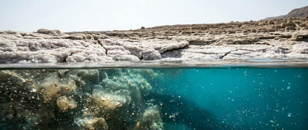
The deepest part of the modern Dead Sea is approximately 280 metres below the water surface, according to a 2025 basin study that cites modern bathymetry. Treat that as an approximate scientific reference, not a live reading. Maximum water depth changes as the lake surface falls, and older sources often describe a deeper lake measured at a higher level.
For area, length, and shoreline change, use the separate Dead Sea size guide.
The three measurements people confuse
Dead Sea depth, surface elevation, and lakebed elevation are different measurements:
- Water depth is the distance from the surface to the lake floor at a particular point.
- Surface elevation is the height of the water surface relative to mean sea level.
- Lakebed elevation is the height of the bottom relative to mean sea level.
The Israel Water Authority recorded the surface at 441.50 metres below mean sea level on 4 October 2026. That number is not the lake’s depth. The current water level guide keeps the official date beside the measurement, while the elevation guide explains the reference point.
A Dead Sea depth claim needs a date and a definition. The surface is moving, bathymetric surveys are not continuous, and some maps visually join the natural northern lake with southern industrial ponds. A precise looking number can still describe the wrong measurement or the wrong body of water.
Where the deepest water is
The deep natural lake occupies the northern basin. The modern research figure of roughly 280 metres refers to the deepest part of that open lake, not to water at a visitor beach and not to the southern pond system.
South of the Lisan Peninsula, much of the former shallow southern basin is occupied by industrial evaporation ponds managed in Israel and Jordan. The hotel beaches around Ein Bokek and Neve Zohar face this pond system. It remains a saline floating environment, but it should not be used to answer how deep the northern lake is.
The location guide shows how the two countries and the basin sections fit together.
Why older sources give a larger depth
When the water surface is higher, the vertical distance to a given point on the lake floor is greater. As the surface falls, the water column above that point becomes shallower. This is one reason older references often quote about 300 metres or more while recent research uses a figure closer to 280 metres.
The bottom is not a perfectly unchanging plate. Sediment and salt continue to accumulate, and bathymetric methods have their own uncertainty. Even so, the rapid change most travelers notice comes from the falling surface and retreating shoreline. The Dead Sea environment guide explains the linked changes on land.
The Dead Sea is both extremely low and very deep, but those ideas are not interchangeable. Its surface lies hundreds of metres below global mean sea level, then the lake extends hundreds of metres farther downward. Depth describes the water column; elevation describes where that column sits on Earth.
How the basin became so deep
The Dead Sea sits in a tectonic basin along the Dead Sea Transform, the plate boundary between the Arabian Plate and the Sinai side of the African Plate. Fault motion and subsidence created space that later filled with sediments, salt, and a succession of lakes.
The modern water body is only the top of a much deeper sedimentary basin. That geological structure should not be confused with the present water depth. Read how the Dead Sea formed for the longer sequence.
Does depth cause people to float?
No. Buoyancy depends on the density of the brine and the volume of water displaced by the body, not on whether the lake is 2 metres or 280 metres deep beneath a particular point. The salinity guide explains the concentrated brine, and why people float explains the force balance.
Deep water also does not make the Dead Sea suitable for diving. Visitors should use a managed beach, remain face up, avoid head immersion, and follow the posted instructions. The Dead Sea safety rules take priority over any depth fact.
Questions visitors ask
What is the maximum depth of the Dead Sea today?
A 2025 basin study describes the deepest lake floor at approximately 280 metres below the water surface. It is a useful modern approximation, not a continuously updated gauge. The figure is approximate and should not be read as an exact depth for today.
Is the Dead Sea 441.50 metres deep?
No. The 441.50 metre figure is the surface elevation below mean sea level the Israel Water Authority recorded on 4 October 2026. It tells you where the water surface sits relative to the global reference, not how far the lake extends from surface to bottom.
Can visitors reach the deepest part?
Ordinary beach access does not take visitors to the deepest central basin, and the Dead Sea is not a recreational diving destination. Use a managed bathing area and stay within its marked boundaries. Floating is a shore based experience governed by local safety instructions.
Is the southern basin as deep as the northern lake?
No. The northern basin contains the deep natural lake. Much of the former shallow southern basin is now occupied by managed industrial evaporation ponds. Maps may show both in blue, so check what a measurement includes before comparing areas or depths.
Will the Dead Sea become shallower as its level falls?
Yes, the water column above a given point generally becomes shallower when the surface falls. The future is not a simple countdown to zero, because inflow, evaporation, pumping, salt deposition, basin shape, and policy all matter. Use dated measurements rather than a fixed disappearance prediction.