Overview
The Dead Sea sits in the Middle East within the Jordan Rift Valley, forming part of the border between Israel (and the West Bank) to the west and Jordan to the east. Its surface rests approximately 440 meters below sea level, making the Dead Sea shoreline the lowest exposed land surface on Earth. The lake occupies a deep tectonic basin centered at approximately 31 degrees 30 minutes north latitude and 35 degrees 30 minutes east longitude.
The Dead Sea occupies the floor of the Jordan Rift Valley at approximately 440 meters below sea level, positioned between Israel and Jordan in the Middle East, making its shoreline the lowest land surface anywhere on Earth and creating atmospheric conditions found at no other inhabited location.
Exact Location and Borders
The Dead Sea straddles three political entities. The western shoreline falls under the jurisdiction of Israel and the Palestinian Authority (West Bank). The eastern shoreline lies entirely within the Hashemite Kingdom of Jordan. A north-south dividing line through the center of the lake marks the approximate boundary.
The basin sits within the larger Syrian-African Rift system, a tectonic fault line stretching from southeastern Turkey to Mozambique. This rift created the depression that now holds the Dead Sea, the Sea of Galilee to the north, and the Gulf of Aqaba to the south.
How Far Is the Dead Sea from Major Cities?
The Dead Sea is surprisingly accessible from several major regional cities. Jerusalem lies approximately 25 to 30 km to the west by direct distance, reachable in roughly 60 to 90 minutes by car via Route 1 and Route 90to the northern shore, or approximately 90 km to the southern resort area of Ein Bokek. Tel Aviv sits approximately 170 km to the northwest, a drive of about two hours. Amman, Jordan’s capital, is roughly 55 km to the northeast, with driving times of approximately one hour via the Jordan Valley road.
Additional reference distances include Eilat at approximately 190 km to the south, Bethlehem at roughly 30 km to the west, and Petra at about 230 km to the southeast via the King’s Highway.
Jerusalem sits approximately 90 kilometers west of the Dead Sea, connected by a descent of more than 1,200 meters in elevation that takes roughly 60 to 90 minutes by car, making the Dead Sea one of the most geologically dramatic day trip destinations from any capital city.
The Surrounding Landscape
The terrain around the Dead Sea is defined by dramatic geological contrasts. To the west, the Judean Mountains rise steeply through fault scarps of limestone and dolomite, reaching elevations above 1,000 meters. To the east, the Moab Mountains and Transjordanian highlands form a wall of Nubian Sandstone. This positioning places the Dead Sea at the bottom of a deep trough.
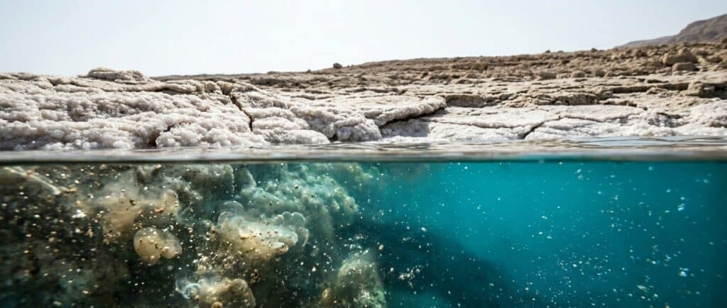
Rainfall in the Dead Sea basin averages less than 50 millimeters per year. The Jordan River enters from the north as the primary tributary, but no rivers flow out. Evaporation is the sole mechanism for water loss, which is why minerals have concentrated to extreme levels over geological time.
What This Means for Visitors
The Dead Sea’s location between two national borders means visitors can access it from either the Israeli or the Jordanian side, with each offering distinct experiences. The Israeli side, centered on Ein Bokek, provides free public beach access and developed tourist infrastructure. The Jordanian side features resort beaches near Sweimeh and the Amman Beach public area.
The extreme low elevation creates a unique microclimate. Atmospheric pressure at the Dead Sea measures approximately 5% higher than at sea level, which increases oxygen density. The thick atmospheric column also filters certain wavelengths of ultraviolet radiation, contributing to the region’s documented therapeutic conditions.
Related Questions
Is the Dead Sea in Israel or Jordan?
Both. The Dead Sea sits on the border between Israel (and the West Bank) to the west and Jordan to the east. Visitors can access it from either country.
What continent is the Dead Sea on?
The Dead Sea is in Asia, within the Middle East region. It lies at the junction of the Arabian and African tectonic plates.
Is the Dead Sea really a sea?
No. Despite its name, the Dead Sea is a landlocked hypersaline terminal lake. It has no connection to any ocean. The Jordan River flows in from the north, but no water flows out.
FAQs
What countries border the Dead Sea?
Three political entities share the Dead Sea shoreline: Israel to the southwest, the West Bank (Palestinian territories) to the west, and Jordan to the east. Visitors can access the lake from both the Israeli and Jordanian sides, though border crossings between the two require advance planning.
How deep is the Dead Sea?
The Dead Sea reaches a maximum depth of 304 meters (997 feet) in its northern basin, making it the deepest hypersaline lake in the world. The southern basin is significantly shallower, with many areas less than 6 meters deep.
Can you see Jordan from the Israeli side of the Dead Sea?
Yes. The Dead Sea measures only about 15 kilometers at its widest point, so the Jordanian mountains are clearly visible from the Israeli shore. On clear days, the rust-colored cliffs of the Moab range create a striking backdrop to the east.
Is the Dead Sea difficult to reach?
No. The Dead Sea is well connected by paved highways from Jerusalem (approximately 90 km, 60 to 90 minutes), Tel Aviv (approximately 170 km, 2 hours), and Amman (approximately 55 km, 1 hour). Public buses, organized tours, and rental cars all provide reliable access.
Why is the Dead Sea so low?
The Dead Sea occupies a tectonic depression created by the Dead Sea Transform fault system, part of the Great Rift Valley. This geological process, active for approximately 3 million years, continues to deepen the basin. Water levels are also dropping approximately 1 meter per year due to reduced inflow from the Jordan River.