By DeadSea.com Editorial
Last reviewed: September 2026
The Dead Sea has no single birth date because its tectonic basin, Lake Lisan and the present hypersaline lake belong to different stages of one long geological sequence. Human settlement, sacred texts, fortresses, manuscripts, mineral production and tourism came later; on 4 October 2026, the measured water surface stood 441.50 metres below mean sea level, according to the Israel Water Authority.
The chronology below keeps those different clocks separate. Geology unfolds over immense spans, while written, archaeological and government records locate later events in years or centuries.
Timeline at a glance
The Dead Sea story moves from geological change measured across millions of years to shoreline loss visible within a lifetime. Across these ten entries, the scale contracts from vast geological periods to a single government measurement.
| Period | What changed |
|---|---|
| Millions of years | Movement along the Dead Sea Transform formed and deepened basins through repeated faulting and subsidence. |
| Approximately 70,000 to 15,000 years ago | Lake Lisan occupied much more of the Jordan Rift Valley, then retreated as climate and water balance changed. |
| Fourth to third millennia BCE | Chemical evidence traces Dead Sea bitumen through trade networks in Canaan and Egypt. |
| Late Hellenistic and Roman periods | Qumran was occupied near the northwestern shore, Herod expanded Masada, and rebels later held the fortress during the First Jewish Revolt. |
| Third century BCE to 68 CE | The manuscript library recovered near Qumran was copied and assembled across several centuries. |
| Nineteenth century | Surveyors introduced more systematic mapping, depth measurements and chemical study. |
| 1929 to the early 1930s | Palestine Potash Limited was incorporated, received the concession and began commercial production. |
| 1947 onward | The first seven Dead Sea Scrolls came to wider attention, followed by discoveries in ten additional caves near Qumran. |
| Mid-twentieth century onward | Upstream diversion and brine pumping drove a sustained decline, while Israel and Jordan established separate visitor systems. |
| 4 October 2026 | The Israel Water Authority recorded the surface at 441.50 metres below mean sea level. |
From a tectonic basin to the present lake
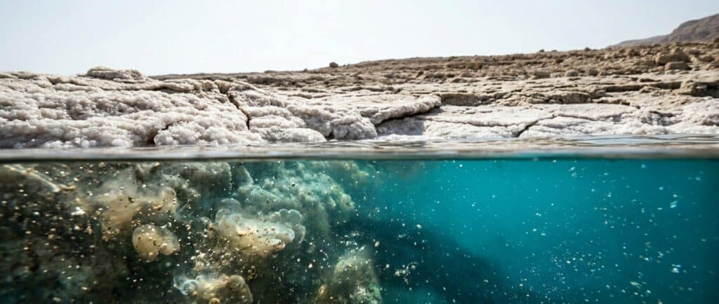
The Dead Sea basin developed over geological time along the Dead Sea Transform, a fault system between the Arabian Plate and the Sinai subplate to the west. Repeated movement created and deepened depressions that accumulated water, sediment and salt; neither the landscape nor its shoreline appeared in one event.
In the last glacial period, Lake Lisan filled a much larger part of the Jordan Rift Valley. Research places that water body at approximately 70,000 to 15,000 years ago, with substantial changes in level and salinity throughout the span. Pale, finely layered deposits around the region remain evidence of its former extent.
As climate and the watershed balance shifted near the end of that period, Lake Lisan retreated. Today’s hypersaline lake developed in the deepest remaining depression. A claim that everything called the Dead Sea is one precise age therefore compresses three related but distinct subjects: the faulted basin, its larger predecessor and the present water body.
The Dead Sea environment page explains how inflow, evaporation and a terminal drainage system shape the lake now.
Early settlement, routes and traded resources
People used the wider Jordan Valley long before the kingdoms and empires named in later writing. Springs, cultivable oases and routes running north to south supported settlement and movement through a difficult dry landscape.
Bitumen that surfaced from the lake became a traded material. Chemical studies identify a Dead Sea origin for bitumen in ancient objects and Egyptian mummification materials, with exchange reaching back into the fourth and third millennia BCE. This was one changing resource economy, not a continuous version of today’s mineral industry.
Ein Gedi added a different form of value. Archaeology documents ancient irrigation terraces around the oasis, while written sources associate it with dates and costly balsam in Roman and Byzantine times. Those records complement each other but do not establish one uninterrupted crop history.
The Salt Sea in biblical tradition
Biblical texts refer to the Salt Sea, Ein Gedi, wilderness routes and the cities of the plain. These writings shaped the religious meaning of the region and influenced how later travelers interpreted its geography.
A name in a sacred text is not automatic archaeological proof for a proposed location on today’s map. Text, tradition and material remains answer different questions. The Dead Sea Bible history page follows those connections without treating every identification as settled.
Qumran, Masada and Roman rule
In the late Second Temple period, the western shore included farms, settlements, fortresses and roads linking the Jordan Valley with Jerusalem and the desert interior. Qumran and Masada preserve very different parts of that landscape.
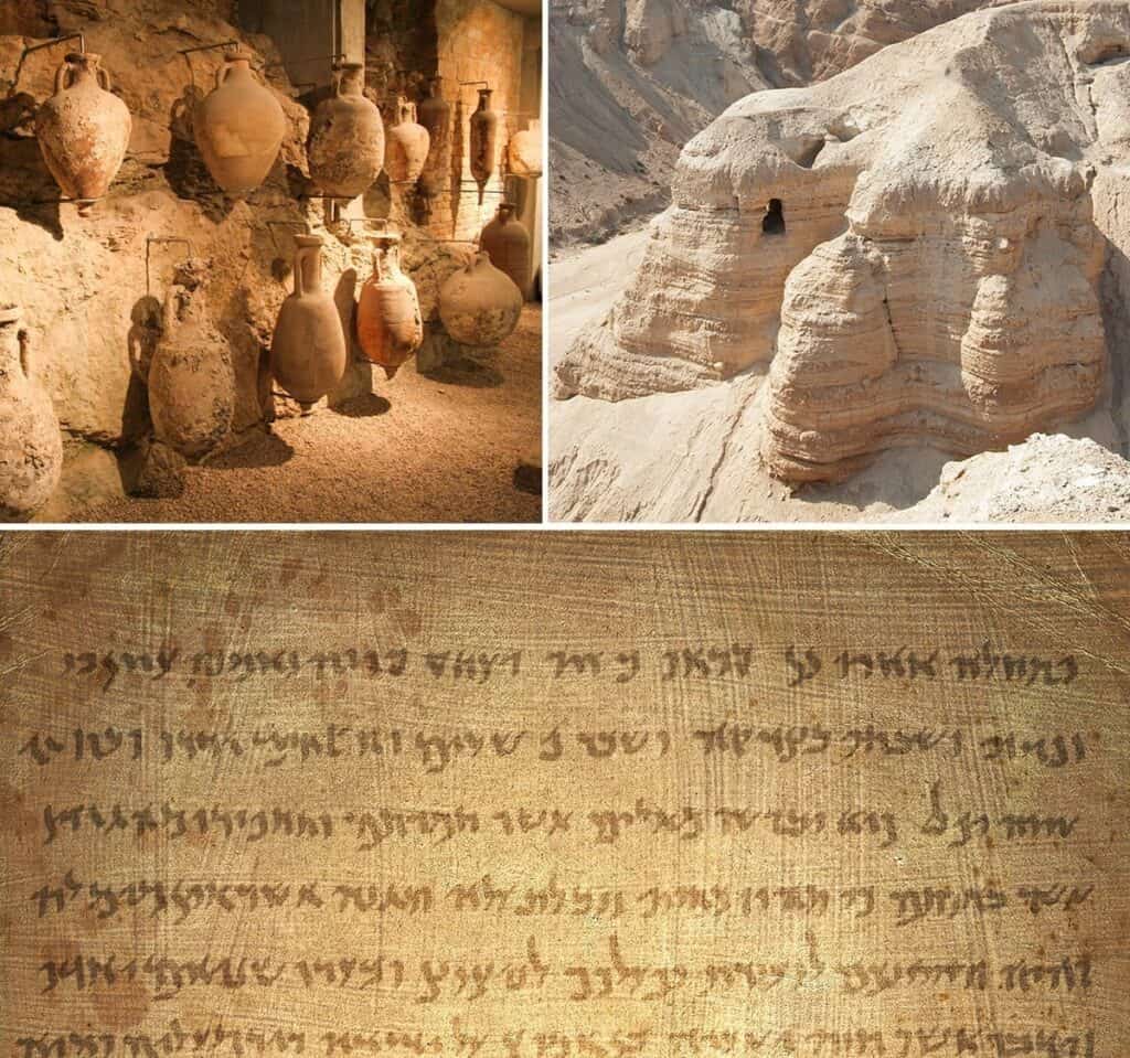
Qumran was occupied during portions of the late Hellenistic and Roman periods. Many scholars connect the settlement with manuscripts placed in nearby caves, although the precise relationship among the buildings, caves and people who assembled the library remains debated.
At Masada, Herod the Great built a fortified palace complex during his reign from 37 to 4 BCE. Jewish rebels occupied it during the First Jewish Revolt. Roman forces then surrounded the mountain with camps, a wall and an assault ramp before taking it in 73 or 74 CE. The Masada history article separates the physical siegeworks from Josephus’s account of the final night.
The Dead Sea Scrolls belong to two dates
The Qumran manuscripts were copied from approximately the third century BCE to 68 CE, centuries before their first modern discovery in 1947. Keeping composition and discovery apart places the texts in Second Temple Judaism while preserving the separate history of archaeology in the 1900s.
The library contains biblical manuscripts and other Jewish legal, liturgical, interpretive and apocalyptic works in Hebrew, Aramaic and Greek. It reveals a varied textual and religious world rather than one uniform book collection.
The first seven scrolls came to wider attention in 1947. Searches and excavations in the following years recovered manuscripts or fragments from ten additional caves near Qumran. The Israel Antiquities Authority describes more than 900 manuscripts represented by tens of thousands of fragments.
The Dead Sea Scrolls overview examines the collection itself. The discovery year should never be used as the date when the texts were written.
Pilgrims, geographers and surveyors
Jewish, Christian and Muslim traditions continued to attach meaning to the Jordan Valley and its salt lake. Pilgrims, geographers and other travelers recorded inherited stories alongside direct observations of the shore, roads and water.
Nineteenth-century expeditions brought more systematic mapping, soundings and chemical description. Their reports are valuable records of the lake at that time. A depth, salinity or coastline measurement from those journeys cannot be reused as though the instruments, method and shoreline were unchanged.
Industry divided the southern basin
Dead Sea mineral extraction expanded during the British Mandate. Palestine Potash Limited was incorporated in London in 1929, received the Dead Sea concession in 1930 and began production in the early 1930s. A narrower single-year date for first or commercial potash production is not settled.
After the 1948 war, the extraction systems developed separately. Dead Sea Works rebuilt operations near Sdom on the Israeli side. The Arab Potash Company, founded in 1956, established its own system east of the international boundary in Jordan.
Large evaporation ponds now occupy much of the former shallow southern basin. They are engineered industrial water bodies supplied by pumping from the deeper northern lake. A map may colour both areas blue, but their water levels and shorelines do not operate in the same way.
Tourism grew through two country systems
The Dead Sea’s western and eastern shores share a lake but not one visitor network. Israel developed the Ein Bokek resort zone and a Road 90 corridor linking beaches, parks and archaeological sites; its planning belongs in the Israel visitor guide.
Jordan developed hotels and managed access along the eastern shore under different roads, operators and entry rules. That journey belongs in the Jordan planning guide. A regional history can include both countries without blending their hotels, transport or practical instructions.
Why the water surface is falling
The Dead Sea’s sustained decline reflects a water budget in which inflow no longer balances evaporation and industrial withdrawal. Large upstream diversions reduced Jordan River basin supply during the twentieth century, while Israeli and Jordanian producers pump brine into southern evaporation ponds; the practical results include a receding shore, stranded infrastructure and sinkholes in affected areas.
As the water table falls, fresher groundwater can dissolve buried salt along parts of the margin. Cavities may then collapse. This mechanism explains why an old shoreline path or abandoned facility is not a safe access route.
Two current measurements show different dimensions of the change:
- The Israel Water Authority measured the surface at 441.50 metres below mean sea level on 4 October 2026.
- A 2026 satellite study mapped approximately 592.37 square kilometres of water for 2022, compared with approximately 1,019.33 square kilometres in 1971 under the same method.
The first value is a dated elevation observation. The second compares mapped area between 1971 and 2022. Neither should be converted into a timeless annual rate, and an industrial pond should not be treated as if it were the natural northern lake. The Dead Sea size page follows these measurement differences in more detail.
Frequently asked questions
How old is the Dead Sea?
There is no single age for everything the name describes. The tectonic depression developed over millions of years, Lake Lisan occupied the rift during the late Pleistocene, and the present hypersaline water body formed after that larger predecessor retreated.
When did Lake Lisan exist?
Lake Lisan occupied much of the Jordan Rift Valley from approximately 70,000 to 15,000 years ago. Its level and salinity changed considerably within that span.
When were the Dead Sea Scrolls written and found?
The Qumran manuscripts date from approximately the third century BCE to 68 CE. The first seven scrolls came to wider attention in 1947, and manuscripts or fragments were later identified in ten more nearby caves.
When did industrial mineral production begin?
Palestine Potash Limited was incorporated in 1929, received the concession in 1930 and began industrial production in the early 1930s. After 1948, separate Israeli and Jordanian operations developed.
When did the current environmental decline begin?
The lake has always fluctuated, but its rapid sustained fall is tied to twentieth-century water diversion and industrial brine pumping, with the change becoming pronounced around the middle of the 1900s. Use dated gauge observations for precise comparisons because the loss is not identical every year.