Overview
The Dead Sea covers roughly 600 square kilometres, but no exact area remains correct forever. A 2026 satellite study mapped about 592.37 square kilometres for 2022. On 4 October 2026, the Israel Water Authority recorded the surface at 441.50 metres below mean sea level. Area and level describe different things, and both need a date.
Start with where the Dead Sea is if you are trying to match these figures to a map.
The useful size numbers
Remote sensing researchers mapped the lake at about 592.37 square kilometres in 2022. A separate modern basin study describes an area near 600 square kilometres and a deepest lake floor around 280 metres below the water surface.
Those figures are approximations from different methods and observation periods. They should not be combined into a false snapshot. The current water surface level comes from a government gauge series, while surface area comes from mapped imagery and a chosen shoreline definition.
A Dead Sea measurement is incomplete without three labels: what was measured, when it was measured, and how it was measured. Water level, surface area, maximum depth, length, and width change differently. Numbers from different years can all be valid while describing different versions of the lake.
Why there is no timeless length or width
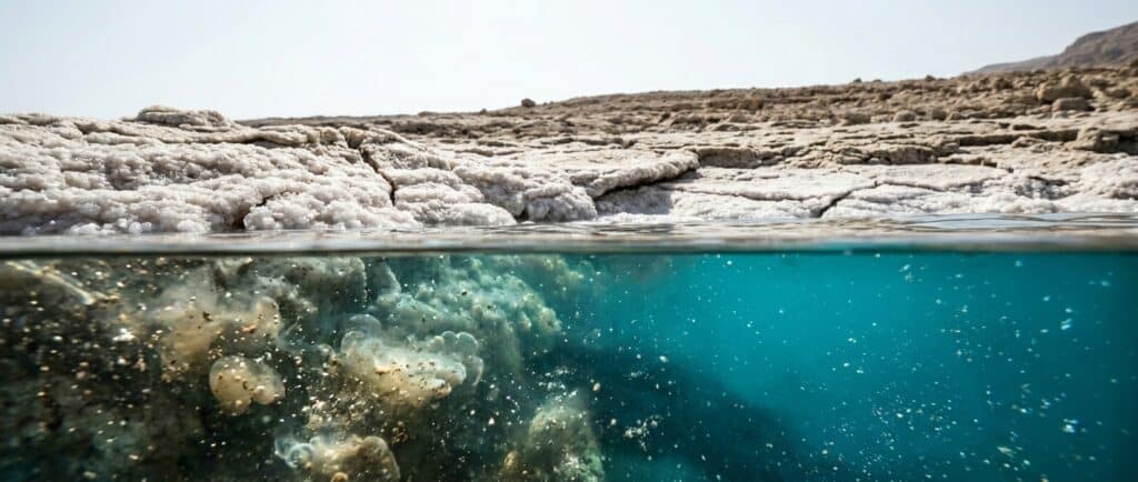
The lake is long and narrow, but retreat is not uniform around every bay and peninsula. As level falls, shallow margins withdraw more visibly than steep sections. A fixed width from one year can overstate or understate another shoreline.
Length also depends on what counts as the natural lake. The southern evaporation ponds are industrial water bodies and should not automatically be added to the deep northern basin as if both form one unchanged lake.
For a concise set of physical anchors, use the Dead Sea facts guide.
For the causes and consequences of retreat, use the Dead Sea environment guide.
The northern basin and southern ponds
The deep northern basin is the main natural body of open water. South of the Lisan Peninsula, much of the former shallow southern basin is now occupied by industrial evaporation ponds used by mineral producers in Israel and Jordan.
Maps sometimes color the northern lake and southern ponds as one continuous blue shape. That can be useful for orientation, but it is misleading for a natural surface area calculation. A source must state whether it measures the open northern lake, the pond system, or both.
Travelers also need this distinction. The hotel beaches near Ein Bokek and Neve Zohar face the managed pond system, while many classic lake measurements refer to the deep northern basin. The water experience is organized and saline, but the basin context is not identical.
How much has the lake shrunk?
The 2026 remote sensing study mapped about 1,019.33 square kilometres in 1971 and 592.37 in 2022. Its method produced a decline of roughly 42 percent between those mapped years.
That comparison is more useful than saying the lake loses one fixed area every year. Shoreline shape, annual inflow, pumping, evaporation, and measurement method affect the mapped change.
The water surface level also continues to fall. Use the Dead Sea water level guide for the latest dated series rather than treating any one observation as permanent.
The shrinking Dead Sea is not simply a smaller copy of its former outline. Shore retreat exposes broad flats in some places, changes beach access, separates old infrastructure from the water, and alters groundwater conditions. The practical landscape can change even where the view across the basin still looks immense.
Depth is a separate measurement
Maximum depth changes as the water surface falls. A modern study describes the deepest lake floor at roughly 280 metres below the present water surface. Older sources often give a larger depth measured when the surface stood higher.
Do not confuse maximum water depth with elevation. If the surface is hundreds of metres below global mean sea level and the lake extends hundreds of metres farther down, the deepest lake floor has an even lower elevation.
The why you float guide explains density, which is separate again. Deep water is not what causes buoyancy.
What size means for a visitor
The opposite mountain wall can be visible across the water, yet that does not make the other country locally accessible. Israel and Jordan remain separate travel systems. Use the Israel guide or Jordan guide according to the shore you will visit.
A receded shoreline also changes walking access. Do not follow old imagery across unmanaged ground. Use current roads, declared beaches, and staffed attractions because sinkholes and unstable surfaces occur in affected shore areas. The Israel Dead Sea beaches guide routes visitors to managed access.
Frequently asked questions
What is the current surface area of the Dead Sea?
There is no single live area reading. A peer reviewed 2026 remote sensing study mapped about 592.37 square kilometres for 2022. A current answer should always state the observation year and method because the shoreline continues to retreat and different studies may define the measured water boundary differently.
How deep is the Dead Sea?
A modern basin study describes the deepest lake floor at roughly 280 metres below the water surface. The maximum water depth changes as the surface level changes. Older sources may report a greater depth from an earlier, higher lake level, so the date and method matter.
How far below sea level is the Dead Sea?
The Israel Water Authority recorded the water surface at 441.50 metres below mean sea level on 4 October 2026. That is a dated gauge observation. It is not the depth of the lake and it will change as the surface level continues to fall.
Are the southern evaporation ponds part of the Dead Sea?
They occupy much of the former shallow southern basin and contain saline water used for industrial mineral production. For mapping they may appear connected with the Dead Sea system. For a natural lake area or depth claim, a source should state clearly whether those managed ponds are included.
Can you see across the Dead Sea?
The mountains on the opposite side are often visible in clear conditions, but visibility varies with haze, weather, and location. Seeing the other shore does not provide a crossing. Israel and Jordan travel requires appropriate roads, border procedures, and country specific planning.