The Dead Sea is shrinking because much less water reaches this closed basin than evaporation and industrial pumping remove.
That deficit connects many visible changes: a lower surface, a retreating shoreline, shifting groundwater, exposed salt deposits, longer access routes, and sinkhole risk in affected areas. The water-level record shows why each measurement needs a date.
The Israel Water Authority table lists a water elevation of 441.50 metres below mean sea level for 4 October 2026. A separate 2026 remote-sensing study mapped 592.37 square kilometres of water in 2022 under its own method. Elevation and area describe different things, so neither number should stand in for depth, volume, or conditions at a particular beach.
A closed lake in a tectonic basin
The lake occupies a deep depression within the Dead Sea Transform, where long-term movement between the Arabian Plate and the Sinai side of the African Plate created space for thick layers of sediment and evaporite deposits. The modern surface is only the latest stage in a much older geological history.
Water enters through the Jordan River system, seasonal streams, floods, springs, and groundwater. No natural river carries it onward to an ocean. Loss occurs mainly through evaporation, leaving dissolved material behind.
The location overview places Jordan on the eastern shore and Israel and the West Bank on the western side. That shared geography does not create a shared visitor network; border crossings, roads, parks, beaches, and emergency information remain country specific.
The natural open lake now occupies the deep northern depression. The shallow southern part became an engineered evaporation-pond system used by mineral producers in Israel and Jordan. A blue patch on a map may therefore represent either the main body or managed industrial water.
The size explainer separates surface area, length, width, depth, and elevation. This distinction matters because a gauge in the north and a resort beside a southern pond are not measuring the same physical system.
Why the Dead Sea environment is so salty
As evaporation removes water, dissolved material becomes concentrated. A Geological Survey of Israel analysis measured total dissolved salts near 340 grams per litre in 2011, close to ten times the ocean average. The salinity explanation gives the units and sampling limits behind that shorthand.
The chemistry is also unusual. Magnesium, calcium, potassium, sodium, and chloride occur in proportions unlike ordinary seawater. High density produces familiar buoyancy, but it does not make the liquid safe to swallow or splash into the eyes. The physics is covered in why people float, while the swimming rules set out safer entry and exit.
Summer heating can create a warm upper layer. Cooling later in the year promotes deeper mixing, with timing and temperature varying by weather, depth, and location. The water-temperature page keeps seasonal ranges separate from a same-day forecast.
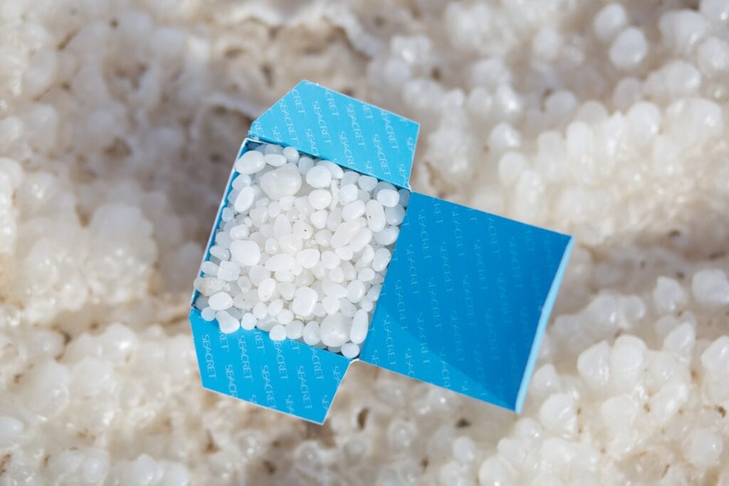
Halite precipitates when the solution reaches the required conditions. Seasonal cooling, mixing, and double-diffusive salt fingers help crystals develop in the water column and on the bottom. The salt-formations article explains those processes without treating an exposed feature as permission to cross unmanaged ground.
Life in the Dead Sea environment
The main brine does not support fish, aquatic plants, or a familiar visible food web. Its concentration and ion mixture overwhelm the regulation used by larger animals, as the no-fish science guide explains.
Microscopic biology persists. Halophilic archaea and bacteria occur in fluid and sediment, while Dunaliella can multiply after rare dilution and nutrient events. Fresh and brackish vents create local transition zones with denser biofilms. The habitat-by-habitat life guide separates those settings.
The desert around the shore is much richer. Freshwater, wadis, cliffs, and oases support plants, birds, mammals, and invertebrates that do not inhabit the lake itself. Ein Gedi Nature Reserve is one western-shore example, with springs and habitat for Nubian ibex and rock hyrax.
Eastern wadis connect Jordan’s uplands with the depression, while the wider rift forms part of a major bird-migration route. A sighting above the shore says something about the regional landscape, not the productivity of the hypersaline water below.
Why the Dead Sea is shrinking
The modern deficit has two principal human components. Upstream dams, diversion, and consumption greatly reduce flow from the Jordan River and its tributaries. Mineral industries also pump lake water into southern ponds, where more evaporates during production.
Climate affects rainfall, runoff, and evaporative demand, but it should not become a vague substitute for a water budget. The contribution of each driver depends on the years, boundaries, and model used. A universal percentage cannot describe every period.
Government sources commonly summarize recent decades as a decline of about one metre per year. It is an average, not a metronome. The monthly series includes seasonal variation, and an exact change should be calculated between two dated observations.
The latest displayed Water Authority value is minus 441.50 metres for 4 October 2026. That is the surface elevation on that date, not the depth of the lake.
Satellite mapping answers another question. The 2026 study Multi-Decadal Assessment of the Surface Area and Water Levels of the Dead Sea Using Remote Sensing Data reported 1,019.326 square kilometres for 1971 and 592.3703 for 2022, a reduction of about 41.9 percent under its method. The result does not mean every segment retreated equally or that volume fell by the same percentage.
What shoreline retreat changes
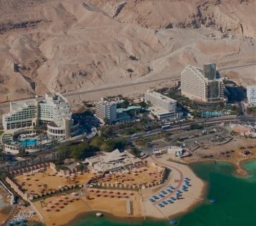
As the edge moves away, former bathing areas, pipes, roads, and buildings can be left farther from the water. Operating venues may add paths, steps, ramps, shuttles, or other managed access. An old pin or aerial image cannot show whether a route remains open.
Retreat also changes the coastal aquifer. In affected western zones, fresher groundwater dissolves buried salt, leaving cavities that can collapse. The Geological Survey of Israel has monitored subsidence and sinkholes with annual LiDAR and high-resolution InSAR since 2012; a newer automated method is being evaluated to speed analysis. Monitoring improves detection, but it does not certify every patch of ground.
For the western visitor system, use the Israel beach inventory to begin with named managed access. On the day, the responsible venue or authority must confirm that the route is open.
Closures are local, not proof that an entire country shore is unavailable. Dead Sea travel alerts provide dated regional context, while the responsible road, park, beach, or emergency authority controls the final decision.
Flash floods are a separate danger. Rain far up a catchment can reach a dry-looking wadi quickly, so the local sky is not a forecast for the whole drainage. Check Dead Sea weather and official warnings before entering any canyon.
Climate in the deep basin
The depression is hot and arid. Israel Meteorological Service climate information for the Jordan Valley places average July and August daytime maxima around 40°C, with parts of the southern valley somewhat higher. Heatwaves can exceed those averages by a wide margin.
Winter usually brings milder days, cooler nights, and most rainfall events. Low elevation changes pressure and temperature, yet it does not remove sunburn, dehydration, or heat-stress risk. The heat-safety article helps turn a forecast into a shorter plan or a decision to stop.
Wind can change conditions at the surface, on exposed viewpoints, and after a float. A forecast for Jerusalem or Amman is not a substitute for the exact shore. For land activity, the hiking overview points to route-specific distance, shade, drinking-water, and closure checks.
Industry, tourism, and conservation
Mineral extraction has operated on both shores for decades. Producers move brine into the southern pond system and concentrate it to recover potash and other materials. These operations support economic activity, but pumping and pond evaporation also form part of the regional deficit.
The distinction between the northern lake and southern ponds is essential for tourism. Beaches beside the ponds can provide a real managed floating experience, yet their banks and levels respond to engineered operations. Figures for the natural northern body should not be applied automatically to those resort areas.
Tourism relies on roads, stable access, functioning beaches, and protected natural and cultural sites. It also uses water and infrastructure. Concentrating visits in managed places reduces exposure to unstable ground and helps keep people away from fragile, unregulated shore.
Proposed responses include restoring more river flow, reducing withdrawals, changing industrial practice, and conveying water or desalination brine from another basin. Every option carries ecological, political, energy, cost, and quality tradeoffs. A proposal or agreement is not an operating rescue project, and no single measure should be called a solution without measured effects on the water budget.
What visitors can do responsibly
Choose a country first, then keep transport, accommodation, access, rules, and emergency planning inside that travel system. Crossing between the two shores is an international journey, not a drive around an ordinary lake.
For the western side, begin with the Israel Dead Sea hub and verify the named site you intend to use. Do not transfer Israel beach or park instructions to Jordan.
For the eastern side, use the Jordan planning hub and confirm the hotel, day-pass, road, and access details that apply there. Do not assume an Israeli authority covers the Jordanian shore.
At the water, stay within the route opened by staff, follow signs and lifeguards, keep your face up, and avoid swallowing or splashing. On land, respect every fence and closure. Current notices control visits to Masada and Qumran, even when an old itinerary says otherwise.
Conserve tap water at accommodation, use marked bins, and leave salt, mud, plants, wildlife, and archaeological material in place. The first-time visitor plan helps keep one day realistic instead of forcing several distant stops into unsafe hours.
How to understand environmental claims
Ask what was measured, where, when, and by whom before treating a number as current.
| Claim or number | What it can answer | What it cannot answer alone |
|---|---|---|
| Surface elevation on a date | Vertical position of the water surface | Depth, area, volume, or beach access |
| Satellite-mapped area | Extent under one method and year | Equal retreat everywhere or total volume |
| Average annual decline | Trend across a stated period | The exact change in every year or month |
| Sinkhole inventory | Features recorded by a dated monitoring method | Safety of every uninspected location |
| Project announcement | Proposed scope and stage | Funding, operation, effectiveness, or completion |
Separate observation from explanation. A gauge records elevation; a geological study can connect retreat to groundwater and salt dissolution; responsibility across users requires a transparent model. The Dead Sea history hub supplies the longer context for natural variation and human use.
Ancient geology does not make modern measurements timeless. The historical timeline organizes dated milestones without turning them into a single origin story or a current operating notice.
Frequently asked questions
Why is the Dead Sea disappearing?
Inflow no longer balances evaporation and industrial pumping. Upstream use greatly reduced supply from the Jordan River system, while mineral production transfers additional water to southern ponds. Climate influences rainfall, runoff, and evaporative demand, but each contribution depends on the period and model.
How fast is the Dead Sea falling?
Government descriptions use about one metre per year as a recent-decades average, but the rate varies. The Israel Water Authority’s latest displayed observation is minus 441.50 metres on 4 October 2026. Compare dated gauge values for an exact interval instead of applying the average to every year.
Why are there sinkholes near the Dead Sea?
As the shoreline retreats, fresher groundwater reaches buried salt in affected coastal zones, dissolves it, and leaves cavities that can collapse. Visitors cannot identify stable ground by appearance, so current managed access, signs, and closures must control the route.
Is anything alive in the Dead Sea?
Yes. Salt-adapted archaea, bacteria, and Dunaliella occur in the system, with denser communities around some fresh and brackish vents. Fish and ordinary aquatic plants do not inhabit the main brine. Nearby oases and wadis support much richer terrestrial and freshwater habitats.
Can the Dead Sea be restored?
Stabilization would require a large and sustained improvement in the water budget. More river flow, lower withdrawals, industrial changes, and engineered conveyance all have major tradeoffs. No plan should be described as successful until it is authorized, operating, monitored, and large enough to affect the lake.
Is it environmentally responsible to visit?
A visit still uses resources, so its impact is not zero. Use managed beaches and signed trails, respect closures, conserve tap water, avoid litter, and leave natural or archaeological material in place. Responsible behavior reduces avoidable harm but does not erase the wider environmental pressures.