Background and Context: A Landscape of Biblical Proportions
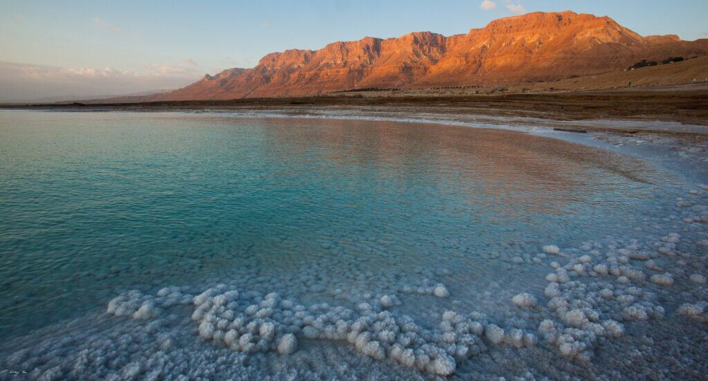
The Dead Sea occupies the lowest exposed land surface on Earth, situated within the Jordan Rift Valley at approximately 439 meters below sea level. Its waters contain roughly 34.2% dissolved salts, nearly ten times the salinity of the Mediterranean, a concentration that has shaped the basin’s physical and cultural identity across millennia. This extreme environment provided the geographic and symbolic backdrop for some of the most consequential narratives in the Hebrew Bible, the New Testament, and early Abrahamic tradition.
Ancient writers did not call it the Dead Sea. The Hebrew Bible refers to the body of water most commonly as the “Salt Sea” (Yam HaMelach), a designation that appears in Genesis 14, Numbers 34, and several other passages. It is also identified as the “Sea of the Arabah” in Deuteronomy 3:17 and 2 Kings 14:25, and as the “Eastern Sea” in Ezekiel 47:18 and Joel 2:20. Each designation reflects a different geographic or cultural vantage point: the extreme salinity, the Arabah Desert corridor in which the basin sits, or the orientation of the water body relative to Jerusalem and the central highlands.
The Dead Sea is referenced in more than 20 passages across the Hebrew Bible under three primary Hebrew names: the Salt Sea (Yam HaMelach), the Sea of the Arabah, and the Eastern Sea. This range of designations reflects the body of water's geographic and symbolic importance to multiple Israelite tribes and scribal traditions spanning roughly 1,200 years of textual composition.
The Dead Sea basin formed through tectonic activity along the boundary of the African and Arabian plates, which have been sliding past each other along a strike-slip fault at approximately 4 to 6 millimeters per year over millions of years. By the time the earliest biblical texts were being composed, roughly the 10th century BCE, this landscape was already ancient and its extreme characteristics well understood by the populations living around it.
The Dead Sea in Biblical Texts: Names, References, and Narrative Function
Genesis: The Valley of Siddim and the Cities of the Plain
The first substantial biblical engagement with the Dead Sea basin appears in Genesis 14, which describes a military conflict in the “Valley of Siddim” involving four kings from the east and five kings of the Jordan plain, including the rulers of Sodom and Gomorrah. The text notes that the Valley of Siddim was “full of tar pits” (Genesis 14:10), a detail that corresponds archaeologically to the natural bitumen deposits that historically surfaced in the southern Dead Sea basin. Nabataean traders later commercialized this bitumen, selling it across the ancient Mediterranean for use in waterproofing and embalming.
The identification of the Valley of Siddim with the southern Dead Sea basin is a scholarly interpretation rather than a confirmed fact. Several archaeological sites in the region, including Bab edh-Dhra and Numeira on the eastern shore, have been proposed as candidates for the destroyed cities of the plain. These Bronze Age settlements show evidence of occupation and destruction dated to approximately 2300 to 2000 BCE, though the precise connection to the biblical narrative remains a matter of ongoing academic investigation.
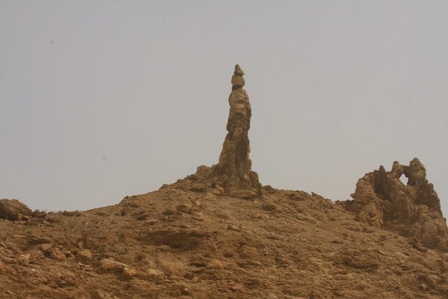
Genesis 19 describes the destruction of Sodom and Gomorrah and the transformation of Lot’s wife into a pillar of salt, a narrative event situated at the southeastern end of the Dead Sea basin. The salt formations on Mount Sodom (Har Sedom), a geological ridge of nearly pure halite on the Dead Sea’s southwestern shore, have been associated with this tradition for centuries. One prominent salt pillar has been known locally as “Lot’s Wife” for generations, though its geological formation is unrelated to any specific historical event.
The Genesis narrative of Sodom and Gomorrah is geographically situated in the southern Dead Sea basin, where naturally occurring bitumen deposits and extreme salinity defined the ancient landscape. Salt formations at Mount Sodom, a halite ridge on the Dead Sea's southwestern shore, have been identified with the Lot's Wife tradition in local and scholarly usage for more than a thousand years.
Numbers, Deuteronomy, and Joshua: Boundary Marker of the Promised Land
In the books of Numbers, Deuteronomy, and Joshua, the Dead Sea functions principally as a geographic boundary marker for the territory promised to and ultimately settled by the Israelite tribes. Numbers 34:3 and 34:12 describe the Salt Sea as the eastern boundary of the southern portion of the Promised Land. Deuteronomy 3:17 identifies it as the eastern limit of the Arabah, the desert corridor running south from the Sea of Galilee through the Jordan Valley. Joshua 3 and 12 use the Salt Sea as a reference point in describing the territories conquered under Joshua’s leadership.
These boundary references are not merely rhetorical. They reflect a practical ancient geographic knowledge of the Dead Sea as an impassable eastern barrier. The hypersaline water, extreme heat, and surrounding desert terrain made the basin a reliable natural frontier, one that defined the eastern edge of the Israelite heartland for the better part of a millennium.
Ezekiel’s Prophetic Vision: The Healing of the Dead Sea
One of the most theologically significant references to the Dead Sea in the Hebrew Bible appears in Ezekiel 47, where the prophet describes a vision of fresh water flowing eastward from the Temple in Jerusalem, descending through the Arabah and emptying into the Dead Sea. In Ezekiel’s vision, this influx transforms the hypersaline water: “When it enters the sea, the water there becomes fresh” (Ezekiel 47:8). Fish multiply in abundance and fishermen line the shore from Ein Gedi to Ein Eglaim, though the text explicitly notes that the surrounding swamps and marshes will remain salty (Ezekiel 47:11).
This passage is notable for several reasons. It names Ein Gedi explicitly, confirming the oasis’s prominence in the ancient geography of the region. It engages directly with the Dead Sea’s most characteristic property, its inability to sustain conventional aquatic life, and frames that characteristic as a condition to be ultimately reversed through divine restoration. The vision is understood in Jewish and Christian eschatological traditions as describing a future transformation rather than a historical event.
Ezekiel’s text is also among the earliest explicit acknowledgments in any ancient source that the Dead Sea is ecologically distinct from other bodies of water in the region. The recognition that this sea required a special act to make it hospitable to fish life reflects a clear awareness of its hypersaline nature, knowledge that would be confirmed by ancient Greek and Roman writers centuries later.
Ezekiel 47 describes a prophetic vision in which fresh water flows from Jerusalem into the Dead Sea, causing the hypersaline water to become fresh and hospitable to fish. The passage explicitly names Ein Gedi as a landmark on the Dead Sea's western shore, making it one of the earliest surviving textual references to the oasis that has a documented history of human occupation spanning more than 5,000 years.
David, Solomon, and Ein Gedi
The oasis of Ein Gedi appears as a named location in two distinct narrative contexts in the Hebrew Bible. In 1 Samuel 23 and 24, Ein Gedi is identified as the site where David sought refuge from King Saul, hiding in the caves of the wilderness of Ein Gedi with several hundred followers. The cave encounter in 1 Samuel 24, during which David spares Saul’s life, is one of the defining episodes in the David narrative.
Ein Gedi also appears in the Song of Songs (1:14), where it is associated with henna blossoms: “My beloved is to me a cluster of henna blossoms from the vineyards of Ein Gedi.” This reference situates Ein Gedi within a poetic and romantic context, suggesting that the oasis was associated not only with refuge and survival but also with cultivation and fragrance in the ancient literary imagination.
Archaeologically, Ein Gedi has yielded evidence of intermittent human occupation spanning more than 5,000 years. A Chalcolithic temple complex established at the site approximately 5,500 years ago was subsequently abandoned for millennia before permanent settlement resumed in the Iron Age, around the 7th century BCE. The oasis’s perennial freshwater springs, fed by rainfall on the Judean Hills, made it a reliable resource in an otherwise hyperarid landscape, which explains both its strategic military value in the David narratives and its agricultural reputation in the Song of Songs.
Zechariah and Joel: The Eastern Sea in Prophetic Literature
The Dead Sea appears in additional prophetic texts under the designation “Eastern Sea.” Joel 2:20 uses the term in a passage describing the removal of a northern enemy from the land, with that army’s front guard driven “toward the eastern sea” and its rear guard toward the Mediterranean. Zechariah 14:8, in an eschatological passage describing Jerusalem’s future, envisions life-giving water flowing both toward the Eastern Sea and the Western Sea (the Mediterranean), a formulation that mirrors Ezekiel’s earlier vision of the Dead Sea’s transformation.
These texts confirm that the Dead Sea remained a consistent geographic reference point in prophetic imagination across the exilic and post-exilic periods, roughly the 6th through 4th centuries BCE. The consistent use of its various names across texts composed over many centuries reflects the body of water’s enduring prominence in the mental geography of ancient Israelite and Judahite writers.
The Dead Sea Scrolls: The World's Oldest Biblical Manuscripts
The most consequential archaeological discovery associated with the Dead Sea region is the cache of manuscripts found in eleven caves near Khirbet Qumran, on the northwestern shore, between 1947 and 1956. These documents, collectively designated the Dead Sea Scrolls, include the oldest known surviving manuscripts of every book of the Hebrew Bible except the book of Esther.
The scrolls were collected, preserved, and in many cases produced by a Jewish sectarian community, most frequently identified with the Essenes, which occupied the Qumran settlement from approximately the 2nd century BCE until 68 CE. Manuscripts predating that settlement were likely brought to Qumran from other locations. The site was destroyed during the First Jewish Revolt against Rome. The community hid their library in ceramic jars placed in the surrounding caves, likely in anticipation of military conflict. The arid climate and stable cave environment preserved the manuscripts for nearly two millennia.
The oldest textual fragments among the scrolls, including portions of the book of Samuel and sections of Exodus, have been dated by paleographic analysis and radiocarbon dating to the 3rd century BCE. This makes them approximately 1,000 years older than the previously known oldest Hebrew Bible manuscripts. The textual variants found in the scrolls have significantly informed modern scholarly understanding of how the biblical text was transmitted and standardized in the Second Temple period.
The Dead Sea Scrolls, discovered in eleven caves near Qumran between 1947 and 1956, include the oldest known manuscripts of the Hebrew Bible, with some fragments dated to the 3rd century BCE. The collection encompasses approximately 900 individual documents and has fundamentally reshaped academic understanding of how the biblical text was preserved and transmitted during the Second Temple period.
Qumran itself is located approximately 2 kilometers from the northern shore of the Dead Sea, at an elevation that places the settlement within the harsh climate of the Judean Desert. The community constructed an elaborate water management system, including a network of cisterns fed by seasonal flash floods, to sustain life in this environment. The proximity of the settlement to the Dead Sea was not incidental: the wilderness and isolation of the shore provided the geographic seclusion that the community sought.
Ancient Historical Accounts: Greek, Roman, and Nabataean Sources
The Dead Sea attracted the attention of ancient scholars and historians beyond the biblical tradition. Aristotle, writing in the 4th century BCE, is among the earliest non-biblical sources to reference the body of water’s unusual properties, noting that its density was sufficient to prevent objects from sinking. Diodorus Siculus, writing in the 1st century BCE, provided a more detailed account in his Bibliotheca Historica, describing the sea’s size, the bitumen trade, and the absence of fish and aquatic life.
Pliny the Elder’s Naturalis Historia (77 CE) contains one of the most comprehensive ancient descriptions of the Dead Sea, addressing its geographic position, the floating properties of its water, and the surrounding landscape. Josephus Flavius, the Jewish historian writing in the late 1st century CE, described the sea in both his Jewish War and Antiquities of the Jews, noting its extent, the salt and bitumen it produced, and the surrounding region’s history.
The Nabataean Kingdom, centered at Petra in present-day Jordan, built significant commercial infrastructure around the Dead Sea basin from approximately the 4th century BCE onward. The naturally occurring bitumen that rose to the surface of the southern Dead Sea was harvested and traded across the ancient Mediterranean world, used for waterproofing ships, sealing mummies in Egyptian embalming practice, and preserving wood. This trade connected the Dead Sea basin economically to Egypt, the Levantine coast, and the broader ancient Mediterranean economy.
Cleopatra VII of Egypt obtained control of certain territories adjacent to the Dead Sea from Mark Antony, reportedly establishing manufacturing and commercial interests in the region. Ancient sources suggest she was interested in both the mineral resources of the area and the balsam groves of Jericho and Ein Gedi, which produced commercially valuable aromatic resins. These accounts, while preserved primarily in Josephus, indicate that the Dead Sea basin was integrated into the broader political economy of the ancient Mediterranean world during the 1st century BCE.
Herod the Great and Masada: Imperial Architecture at the Lowest Point
King Herod I, who ruled Judea as a client king under Roman authority from approximately 37 BCE to 4 BCE, constructed several fortified palace complexes in the Dead Sea region. The most significant of these is Masada, a fortress palace built atop an isolated mesa on the Dead Sea’s western shore, rising approximately 400 meters above the water surface. Herod expanded and elaborated an earlier Hasmonean structure into an elaborate complex including a three-tiered northern palace, a colonnaded western palace, baths, cisterns, storehouses, and extensive defensive walls.
Masada is documented both archaeologically and in the writings of Josephus, who describes the fortress in detail in his Jewish War. Josephus’s account also contains the narrative of the siege of Masada during the First Jewish Revolt, when the Roman Tenth Legion under Flavius Silva captured the fortress in 73 CE, several years after the fall of Jerusalem. The events at Masada, as described by Josephus, have become among the most widely known episodes from Jewish history in the Roman period, though historians continue to debate the accuracy of specific details in his account.
Herod also constructed a palace at Machaerus, on the eastern shore of the Dead Sea in present-day Jordan, which Josephus identifies as the site where John the Baptist was imprisoned and executed. The site has been partially excavated and confirms Herod’s pattern of building defensible palace complexes along the Dead Sea margins, a strategy that combined military security with access to the region’s resources.
Masada, Herod the Great's fortified palace complex on the Dead Sea's western shore, rises approximately 400 meters above the water surface and was built between approximately 37 BCE and 31 BCE. The site's dramatic setting, its documentation in Josephus's Jewish War, and its excavation by Israeli archaeologist Yigael Yadin between 1963 and 1965 have made it one of the most studied late Second Temple period archaeological sites in the world.
Biblical Geography: The Dead Sea as Boundary, Symbol, and Landmark
Throughout the Hebrew Bible, the Dead Sea functions simultaneously as a physical boundary, a narrative setting, and a geographic anchor. As a boundary, it defined the eastern edge of the territories assigned to the tribes of Judah, Benjamin, and Reuben. As a narrative setting, it provided the backdrop for encounters between David and Saul, the destruction of Sodom, and Ezekiel’s prophetic vision. As a geographic anchor, its consistent naming across texts composed across many centuries demonstrates the body of water’s prominence in ancient Israelite spatial cognition.
The Hebrew term Yam HaMelach, the Salt Sea, encodes the defining characteristic of the water body in a single phrase. Salt in the ancient Near Eastern context carried complex symbolic valences: it was associated with preservation, covenant (“a covenant of salt” appears in Numbers 18:19 and 2 Chronicles 13:5), purification, and also with desolation and destruction, as in Deuteronomy 29:23, which describes a devastated land as having soil like salt. The Dead Sea’s extreme salinity thus connected it to multiple layers of meaning simultaneously.
The region also contained sites of cultic and historical significance beyond those directly associated with the water itself. Jericho, located several kilometers north of the Dead Sea’s northern shore, is one of the oldest known settlements in the world, with evidence of episodic habitation stretching back to approximately 10,000 BCE. Archaeological excavations have documented lengthy periods of abandonment, including significant gaps during the Late Bronze Age. It appears repeatedly in the biblical narratives from Joshua to the New Testament. The Jordan River, the Dead Sea’s primary inflow, is the site of the Israelites’ crossing into Canaan in Joshua 3 and the baptism of Jesus in the Synoptic Gospels.
Modern Archaeology and the Dead Sea Region
Archaeological investigation of the Dead Sea region accelerated significantly in the 20th century, following both the discovery of the Dead Sea Scrolls and the establishment of systematic excavation programs by Israeli, Jordanian, and international teams. Beyond Qumran and Masada, significant archaeological sites in the region include Ein Gedi, which has produced evidence of occupation from the Chalcolithic period through the Byzantine era; Jericho; the fortress of Machaerus in Jordan; and multiple Byzantine-period monasteries and hermitages cut into the Judean Desert cliffs.
The Israel Antiquities Authority and the Jordanian Department of Antiquities continue active programs of survey and excavation in the Dead Sea region. The rapidly falling water level of the Dead Sea, which drops approximately one meter per year due to water diversion from the Jordan River and mineral extraction operations, has exposed significant areas of shoreline that were previously underwater or inaccessible, creating both new archaeological opportunities and new preservation challenges.
The Cave of Letters, located in the Nahal Hever canyon on the Dead Sea’s western shore, and the Cave of Skulls, located in the adjacent Nahal Ze’elim canyon, yielded important finds during Israeli expeditions in the early 1960s. The Cave of Letters contained the personal archive of Babatha, a Jewish woman who hid her legal documents during the Bar Kokhba Revolt of 132 to 135 CE, along with letters from Bar Kokhba himself. These documents provide a detailed picture of daily life and legal practice in the Dead Sea region during the Roman period.
Strategic and Cultural Significance: Why the Dead Sea Still Matters
The Dead Sea’s biblical and historical significance operates on multiple levels simultaneously. For religious communities, the region is a landscape dense with documented connections to foundational sacred narratives, a place where the physical environment corresponds verifiably to textual descriptions composed over more than a millennium. For archaeologists and historians, it is among the most productive sites of textual and material recovery in the ancient Near East.
For contemporary travelers, the combination of geological extremity and historical density is unique. No other location on Earth sits at 439 meters below sea level while also containing a UNESCO World Heritage site candidate, the oldest known biblical manuscripts, and an oasis inhabited continuously for 5,000 years within a radius of approximately 30 kilometers.
The Dead Sea’s ongoing environmental crisis, its water level declining approximately one meter per year due to human intervention in the Jordan River’s flow, adds a contemporary dimension to its historical significance. The body of water that served as boundary marker, prophetic symbol, and commercial resource across four millennia of human civilization is now visibly contracting. Understanding that historical record provides essential context for evaluating both what is being lost and why preservation matters.
The Dead Sea basin contains, within a radius of approximately 30 kilometers, the world's oldest known biblical manuscripts at Qumran, an oasis at Ein Gedi with more than 5,000 years of documented human occupation, and a Herodian fortress at Masada that has been excavated to one of the highest standards of any site in the Near East. No other location combines geological extremity with this density of archaeologically verified historical significance.
FAQs
What is the Dead Sea called in the Bible?
The Dead Sea is referred to by three primary names in the Hebrew Bible: the Salt Sea (Yam HaMelach), the Sea of the Arabah, and the Eastern Sea. The terms “Eastern Sea” and “Former Sea” are two English translations of a single Hebrew phrase, ha-yam ha-kadmoni, found in Joel 2:20, Ezekiel 47:18, and Zechariah 14:8. The term Salt Sea appears most frequently, in Genesis 14, Numbers 34, Deuteronomy 3, and several other passages. The name Dead Sea does not appear in the biblical text and is believed to have entered common usage in the Greek and Roman periods.
Where are the Dead Sea Scrolls now?
The majority of the Dead Sea Scrolls are housed at the Israel Museum in Jerusalem, in a purpose-built structure called the Shrine of the Book. Significant portions of the collection, such as the Copper Scroll, are held by The Jordan Museum in Amman (transferred from the older Jordan Archaeological Museum in 2013 to 2014), while the vast majority of remaining scrolls are curated by the Israel Antiquities Authority at the Israel Museum in Jerusalem, and various international institutions. Approximately 25,000 fragments from roughly 900 individual manuscripts have been identified and catalogued since their discovery between 1947 and 1956.
Is Sodom and Gomorrah located near the Dead Sea?
Multiple archaeological sites in and around the southern Dead Sea basin have been proposed as candidates for the biblical cities of Sodom and Gomorrah. Bronze Age sites including Bab edh-Dhra and Numeira on the eastern shore of the Dead Sea show evidence of occupation and destruction dated to approximately 2300 to 2000 BCE. No site has been definitively confirmed as Sodom or Gomorrah, and the identification remains a topic of active scholarly investigation rather than settled fact.
What is the significance of Ein Gedi in the Bible?
Ein Gedi appears in the Hebrew Bible in two distinct contexts. In 1 Samuel 23 and 24, it is the wilderness refuge where David hid from King Saul, and the site of a famous encounter between the two men in a cave. In the Song of Songs 1:14, it is mentioned for its vineyards and henna blossoms. The oasis is also named in Ezekiel 47:10 as a landmark on the Dead Sea’s shore in a prophetic vision of the sea’s future transformation.
Who were the Essenes, and what was their connection to the Dead Sea?
The Essenes are a Jewish sectarian group described by ancient writers including Josephus Flavius, Philo of Alexandria, and Pliny the Elder. The Qumran community that produced and preserved the Dead Sea Scrolls is most commonly identified with the Essenes, though this identification is not universally accepted among scholars. The community occupied the Qumran settlement from approximately the 2nd century BCE until 68 CE, when it was destroyed during the First Jewish Revolt against Rome.
What does Ezekiel 47 say about the Dead Sea?
Ezekiel 47 describes a prophetic vision in which fresh water flows eastward from the Temple in Jerusalem, descends through the Arabah, and enters the Dead Sea, transforming its hypersaline water into fresh water capable of supporting fish. The passage names Ein Gedi and Ein Eglaim as locations where fishermen will work along the revitalized shore. The text is understood in Jewish and Christian eschatological traditions as a description of a future messianic restoration rather than a historical event.
Can visitors access the Dead Sea Scrolls discovery sites?
The caves near Qumran where the Dead Sea Scrolls were discovered are accessible to visitors through Qumran National Park, located on the northwestern shore of the Dead Sea in the West Bank. The park includes the ruins of the Qumran settlement, walking trails to several of the scroll caves, and a visitor center. The caves themselves are not entered but can be viewed from designated paths. The Israel Nature and Parks Authority manages the site, and admission fees apply.